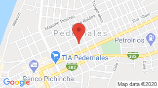
Pedernales


Pedernales Ecuador
Pedernales is a canton that is part of the province of Manabí in Ecuador , its beaches are located on the Pacific coast. Its economic activity is based on tourism. livestock, agriculture and fishing
Pedernales Limits:
It limits to the north with the province of Esmeraldas . To the south with the cantons Jama and Chone . To the east with the canton Chone, to the west with the Pacific Ocean.
Climate of Pedernales: The canton has a humid tropical climate in the upper parts, and dry tropical climate in the lower areas. The average temperature is 23 ° C. Cuenata with two seasons: Rainy - Winter (from January to April) and Dry - Summer (from May to December).
The Pedernales Canton born from the cradle Jama- Coaque culture, here some vestiges of ancient ceramic pieces have been found near the river.
Pedernales’s name means stone, due to the large number of stones in the Esmeraldas riverbed where the Coaque tribe settled.
Cantonization of Pedernales: March 30, 1992
Popular Festivities Pedernales
Among its popular festivals:
- January 10: Parish of Atahualpa
- 28 Marz: parochialization of Cojimíes
- March 31: Cantonization of Pedernales
- April 23: Parish of August 10
- August 1 to 31: month of tourism and rescue of ancestral culture.
- October 24: traditional celebrations of Pedernales.
Pedernales Beach
Pedernales Beach is located in the area that borders the southern Esmeraldas, has many tourist attractions by the sea, in the rivers and mountains, which delights national and foreign tourists.
Pedernales Beach has an approximate extension of 3 kilometers.
Located in the canton of the same name. It occupies 1467 square kilometers of territory.
Pedernales tourism, it is a development pole, because nature has endowed it with different attractions. It is crossed by the Equatorial line.
- It is an open beach of white sand and clear, light green waters. It has an area of approximately 2.5 kilometers and has low cliffs in its northern area.
- A part of the beach serves as parking for fishing vessels, since most of the population of Pedernales is dedicated to artisanal fishing and shrimp farming.
- At low tide it serves as a communication route to Cojimíes,to the north, and La Chorrera to the south.
- 4.5 kilometers south of Pedernales Beach is Punta Los Frailes, a resting place for sea birds that can be reached by walking along the sand.
- Also to the south is Punta Palmar, where in 1736 the members of the French Geodetic Mission located the first point for the measurement of the arc that would determine the shape of the earth.

Publicado en:
Publicado por:


