Quilotoa Ecuador


Quilotoa lagoon
It is known that the Quilotoa lagoon has a volcanic origin with practically 3 km in diameter; holder of greenish waters and a somewhat round figure that make it easy to recognize even with a view from above, it is even easier to find it from a plane approaching Quito from the south.
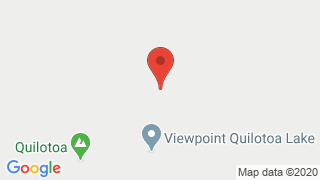
Where is Quilotoa
Laguna de Quilotoa location: This lagoon is located in the Sierra del Ecuador. It is located 15 kilometers from the town of Zumbahua - Zumbahua Parish - Pujilí Canton - Cotopaxi Province, being one of the 24 provinces of Ecuador. This route gives way to the Quiltoa viewpoint, if you decide to continue you can access the Chigchilán parish. You must go prepared since the route takes a time of approximately 4 hours (20 km). On the walk you will be able to observe its closest communities enjoying beautiful landscapes and a pleasant welcome by its inhabitants.
Quilotoa Activities
We recommend you visit the sheltered place since the wind is strong and therefore the cold will attack you, in the same way if you decide to camp inside the volcano you should know that you have to be very well prepared with blankets and warm clothes.
For your safety, if you decide to make a fire, take all safety measures, remember that it must be outside your tent and turn it off when you decide to go to rest.
Among Quilotoa tourist attractions recommended when visiting this place are:
- Camping
- trekking (hiking around the volcano)
- horseback riding
- flora and fauna Observation
- stunning landscape photography
- boat or kayak ride
Tourists in quilotoa can access the place for free, thanks to an agreement signed between the Ministry of Tourism and Environment, the Public Sector Real Estate Management Service (Real Estate), the National Police and the Lake Verde Quilotoa Community Tourist Center .
Quilotoa how to get there
Quilotoa to Quito - In a private vehicle
It is the best recommendation and the easiest way to get to the place but you also have other options such as renting a car or you can get a transport service with a professional person at the wheel and so you can enjoy the landscape much better. If your budget is not so high do not worry there is an option for you too, public transport; buses leave from the Quitumbe terminal in Quito and arrive at Latacunga.
Quilotoa how to get there by bus
Budget between $ 5 and $ 25. There are buses that leave from Latacunga to other towns, it can be said that for a tourist this experience can be a bit frustrating but do not worry, there are some vans which you can rent to transport you from one town to another. An alternative is the morning truck which transports milk between Chugchilán and Sigchos. If your choice becomes one of these, remember that when traveling in the back of a truck the cold is quite strong and the dust can make the situation worse.
Quilotoa Weather
In the Quilotoa lagoon the climate is approximately between 12 degrees Celsius, emphasizing that sometimes it reaches up to 20. If you plan to visit the place you must remember that between January and May the rains are more frequent.
Quilotoa Camping
What to bring to the camp?
- Large backpack or chimbuzo
- Camping tent valid for 3 seasons
- Preferably warm sleeping bag
- Insulating
- Plate, plastic base and spoon
- Headlamp
- Clothing (minimum 2 changes)
- Kit for personal hygiene
What to take for the walk?
- Small comfortable backpack (20 to 30 liters)
- Comfortable and thermal clothing
- Waterproof jacket
- Cap and thermal gloves
- Trekking boots
- Canes (optional)
- Cap, glasses and sunscreen
- Moisturizing Drinks
- Spare clothes
Hiking in the Quilotoa
A volcano with two summits, a heart-shaped hill and a turquoise green lagoon are the main attractions of this reserve. From its foothills are born the slopes for two important rivers, the Toachi, which runs north through a 40-meter high canyon, and the Pilatón. This reveals the importance of the cloud forests of this reserve for generation of water from nearby towns and cities.
The reservation is divided into four sections and you may have visited it without realizing it. The largest includes a long block west of Quilotoa, where the slopes and streams that feed downstream will feed the Toachi River.
The second zone, located to the northeast, is the block where the Ilinizas and the Heart are. The third block is to the southwest, separated from the largest section by the Latacunga - La Maná road. The fourth block is a kind of 800-hectare island that basically surrounds the Quilotoa lagoon.
To get there, take the Pan-American Highway south towards Machachi. From the main road, by a paved road you reach the parish El Chaupi; from here by a second-order route you reach La Virgen sector.
Technical information:
- Difficulty: Hiking, Kayaks
- Act. Permitted: Photography, interpretation, observation of flora and fauna, horseback riding.
- Hours: 08:00 to 16:00
- Justification In favor: Landscaping
- Against: Climatological (fog from very early hours)

Publicado en:
Publicado por:


